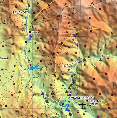
Yesterday evening I changed locations moved about 20 miles (~30 km) North Northwest of Muzaffarabad to the city of Balakot (see Closer to the Epicenter – I have found this title to be a misnomer, though the distruction is much more).
Click Here for a low res map of the effected area (1.7 MB).
Click Here for very high res map of effected area (8.1 MB).
Though the earthquake itself was located in the valley north, north east of Muzaffarabad (yellow astrik but varies by about 5 miles with in that valley depending on whose map), Balakot was one of the hardest hit cities.
Balakot is located in a valley between some very high mountain ranges but we are located only at about 2,600 ft (800 meters). However, the mountains on the east side of the valley tower 10,300 ft (3140 meters). That is one big climb.
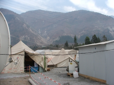
Mountains on the east side of the river in front of the really big ones
The living is pretty nice here too. The internet cafe is in a large tent divided in two. The front half is the internet cafe and the back half is our own personal eating cafe. We sleep in a separate tent which is like the ones in Muzaffarabad.
Our location is right next to an army camp which is very interesting. In the evenings they play volleyball and cricket which I hope to learn.
Well, got to go. More coming.